I stumbled across the SplashMaps stand at the end of the Outdoor Expo this year. I was initially attracted to their stand by the tablecloth maps but David Overton was very passionate about their fabric maps and we got talking about hiking with fabric maps.
Unfortunately, it was the end of a very long show for both of us, and the conversation was a little foggy as we had both been talking nonstop for two days.
But his passion for the product, and a nagging feeling that he may be onto something, eventually got the better of me, and a week later, I ordered a Splashmap from their website for a Brecon Beacons I planned to lead.
After my test walk in the Brecon Beacons, I can confirm that Splashmaps is onto something and that you should investigate further if you hike or paddle. I will now use them as my main map on all my hikes. Here’s how my test day went.
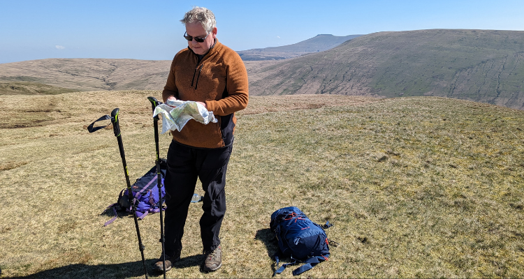
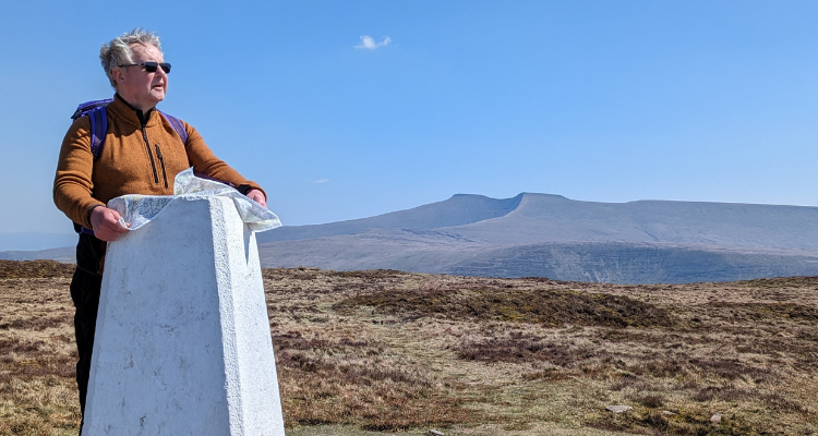 Naming the peaks from the top of Fan Frynych
I had a set of questions I set out to answer on my test day. Here are the answers.
Does a SplashMap fit in your pocket?
Yes. You can stuff the SplashMap into the pocket of your waterproof jacket, buoyance aid or trousers. It is the size of a large handkerchief when scrunched up.
It does take a short time to learn how to scrunch it up so that the area you want is immediately accessible when you take it out.
Is a SplashMap waterproof?
Yes. As you can see from the pictures, it was a beautiful cloud-free day, so I found a mountain stream and gave it a good wash—something I certainly would not do with a map in a map case or my phone.
This test created a wet map I no longer wanted to put in my pocket. However, after 20 minutes attached to the back of my rucksack, it was dry again.
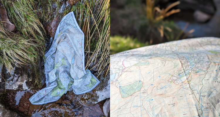 During and 20 minutes after my Splashmap stream test
Can you take compass bearings from a SplashMap?
Yes but… I didn’t have any white-out conditions in the Brecons on test day but I ran a few compass-bearing tests to locate paths and distant peaks. It performed well, but you need to make sure the textile is tight when you take the bearing.
It did feel like you needed three hands to do this on the windy sections of the walk – two to hold the map tight and one to do the bearing, however, using your leg as a rest can solve this problem on a windy day.
Will a SplashMap Rip?
I don’t think so. I swirled it around my head to dry it off after my stream test and treated it roughly during the day. It still looked as good as new at the end of the day.
Will a SplashMap blow away?
I gave this one a good test as the wind was plentiful and robust during the test day. The Splashmap material is heavier than paper so it does not “fly” too far if you let go of it. Certainly less so than a paper map, but more than a paper map in a map case.
Would I use SplashMap as my main Map?
This is the big question and I surprised myself with the answer.
I am a map geek and have been ever since my dad got me into orienteering at a young age (You may have guessed that when I said a map tablecloth attracted me to the Splashmaps stand!)
Maps are a big part of being outside. They tell you about the history of an area and help you see things you would have missed. Without a map, you are just following a path (or the person in front of you). You will experience, understand and see more of the countryside when you use a map.
I have been using OS Maps App on my phone recently, and I do like it. But I go walking for a digital detox and taking my phone out and looking at it at every path junction does not help me detox, especially as it loves to tell me about new emails and messages. The OS Maps App also only shows you a small section of your walk at a time, so it covers the navigation well but still misses the benefits of looking at a large area on a map.
I had started printing maps from the OS Maps App and adding them to my collection of OS 1:25,000, 1:50,000 and Harvey paper maps, but once you put any map in a map case it gets challenging to manage and store on a windy day.
The big winner for me was the reaction of the people I was with. SplashMap is different, so my walking companions were keen to look at it and learn more about the map and the area they were walking – an absolute pleasure. I have never had that reaction using OS maps on my phone or a map in a map case!
I now use it as my main map.
My phone and OS 1:25,000 maps are left at the bottom of my rucksack and are now my backup maps.
Is a SplashMap good value for money?
At the time of writing (May 2023), a 1:25,000 SplashMap covering a custom area costs around £35 for an area of approximately 22x17 km. Preprinted maps, such as the Snowdon map, costs around £26. True, a Splashmap is more than an OS or Harvey map, but it is worth the extra cost and a small price to pay for the benefits.
Having just lost an iPhone to water damage following a wet walk in the Brecons in April, I can confirm that a Splashmap is much cheaper than using OS Maps on a “waterproof” iPhone in the rain!
Conclusion:
I would like to see a way to attach a SplashMap to a carabiner so I can clip it to a rucksack when it gets wet, but I cannot think of anything else to improve the product. I am using it now as my main map and would recommend it to other hikers, Mountain Leaders and touring paddlers.
Final word for other Map Geeks:-
Check out their Mapping products, including their Map my Van option!